美国太空总署(NASA)发布了一个新的地球大地水准面模型,展示了地球重力场的形状。这个模型中,由于地球内部质量分布的差异,表面出现了不规则的隆起和凹陷。为了清楚显示重力场的微小变化,视觉化图像将高度夸大了 10,000 倍,该模型是基于卫星过去 15 年来收集的十亿次观测数据绘制而成。
测量重力场不仅是为了制作视觉图像,更具有重要的科学价值。NASA 和欧洲太空总署的卫星(例如 GRACE 任务)持续监测重力场,以了解气候变暖对极地冰层的影响。数据显示,在 2002 年至 2025 年间,南极洲每年流失约 1350 亿吨冰,而格陵兰岛每年流失高达 2640 亿吨,这对预测未来海平面上升至关重要。
除了冰层流失,GRACE 观测数据还被用于追踪全球地下水枯竭和干旱情况。数据揭示了美国西部等地的长期地下水消耗,以及今年夏天加剧法国和西班牙野火的严重干旱。随著气候变迁使许多地区的干旱恶化,这些重力观测数据能为干旱地区的水资源管理者提供宝贵的参考资讯。
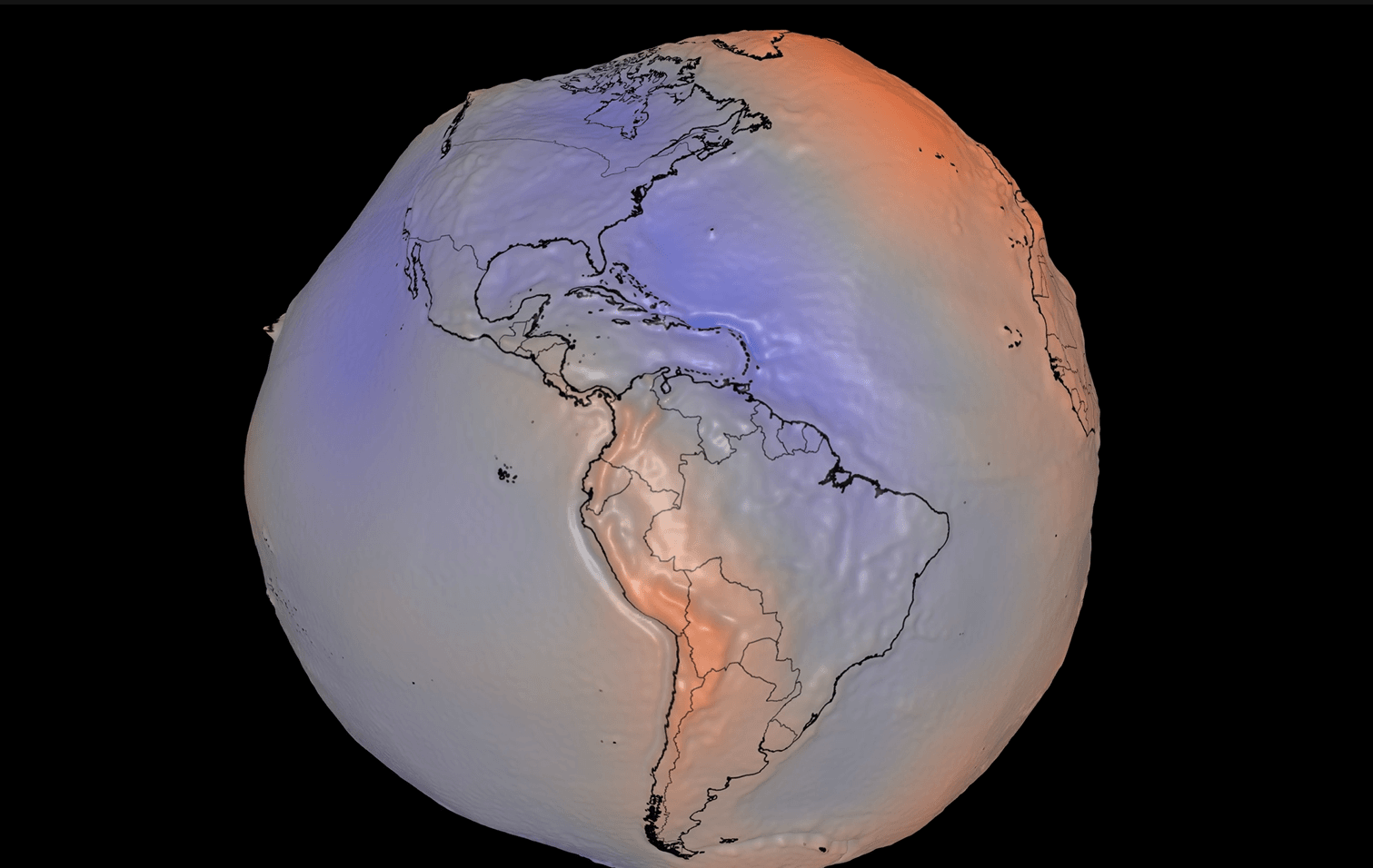
NASA has released a new geoid model illustrating the shape of Earth's gravitational field. In this model, irregular bulges and depressions appear on the surface due to variations in the distribution of mass within the planet. To clearly demonstrate the minute differences in gravity, the visual representation exaggerates heights by a factor of 10,000, and is based on a billion satellite observations collected over the past 15 years.
Measuring the gravitational field is not just for creating visual imagery; it holds significant scientific value. Satellites from NASA and the European Space Agency, such as the GRACE mission, continuously monitor the gravity field to understand the impact of global warming on polar ice. Data shows that between 2002 and 2025, Antarctica lost approximately 135 gigatons of ice per year, while Greenland lost a staggering 264 gigatons annually, which is crucial for predicting future sea-level rise.
In addition to ice loss, GRACE observations have been utilized to track global groundwater depletion and droughts. The data reveals long-term groundwater consumption in areas like the western US, as well as the severe drought fueling wildfires in France and Spain this summer. As climate change exacerbates droughts in many regions, these gravitational observations can provide valuable reference information for water managers in parched areas.